By Cary Chadwick
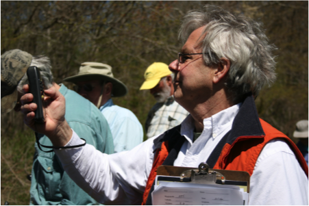
On May 3, CLEAR’s Geospatial Training Program (GTP) and the Connecticut Land Conservation Council held its second session of a training course called “Using GPS for Monitoring and Mapping Land Trust Holdings.”
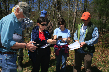
The one-day course is designed to teach participants how to use a handheld GPS receiver to map property boundaries and specific locations that can be monitored annually to determine and record compliance with easement restrictions. The course is also useful for land trusts members and others looking to map trails on their properties.
The hands-on field portion of the training took place on the Haddam Land Trust’s Bamforth Wildlife Preserve, located just a mile from CLEAR’s headquarters. While walking the property, the 18 participants learned how to map property boundaries, trails, and points of interest including hypothetical violations, survey markers, invasive species, and scenic viewpoints. They also spotted a boxed turtle and garter snake. Field photographs were collected to be used in monitoring reports and mapping products. Later, back in the classroom, participants downloaded their GPS data and created interactive, online maps using free software can be shared within their organization or published on their land trust website.
For more information and to learn about future trainings, visit http://clear.uconn.edu/geospatial/training.htm. In addition, CLEAR hopes to partner with the Connecticut Land Conservation Council again in the future to offer a series of workshops for Connecticut’s land trust members focused on best practices in land stewardship.